This store requires javascript to be enabled for some features to work correctly.


Harold Fisk
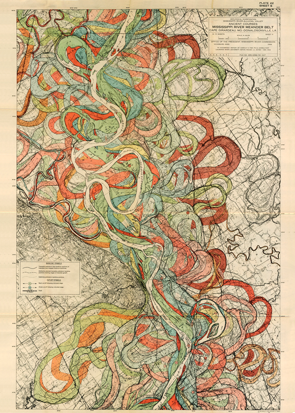
Ancient Courses Mississippi River Meander Belt is a map created by cartographer and geologist Harold Fisk for the U.S. Army Corps of Engineers. Each plate shows a different portion of the Mississippi River and its various courses through time, between Cape Girardeau, MO and Donaldsonville, LA. Some of these channels date back thousands of years.
The maps were part of Fisk’s report Geological Investigation of the Alluvial Valley of the Lower Mississippi River, completed in 1944. The study was conducted to learn about the formation of the valley over time, and the major factors that dictate the river’s flow and flooding in the modern era. The data was collected by creating approximately 16,000 borings that made it possible to analyze the layers of soil and sediment deposits from the river's prior courses deep underground.
Fisk drew more than geographic data—he also found the river's heart in this jumble of loops and purls. The river finds its personality reflected in this explosive, earth-toned palette, its constantly churning rhythm shaping the soil, digging out an ever-changing path distinctively its own. From prehistory to the 20th century, these maps are made for the ages.